LOG IN. UPLOAD PICTURES.
The Philippines has Zambo Mart to help propagate the Chavacano Language.
File:Manicahan aerial view.jpg
Revision as of 07:09, 7 March 2015 by Maletsky (talk | contribs) (→Manicahan Zamboanga City Philippines)

Size of this preview: 800 × 480 pixels. Other resolution: 960 × 576 pixels.
Original file (960 × 576 pixels, file size: 115 KB, MIME type: image/jpeg)
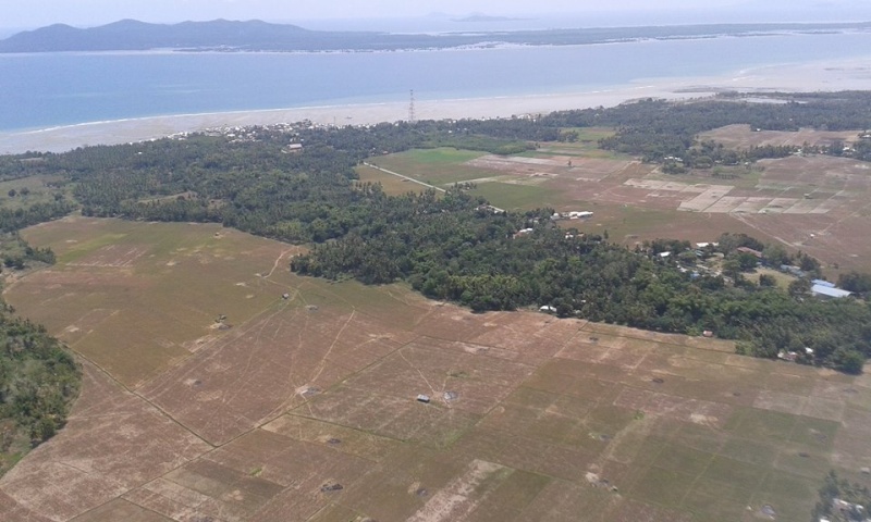
Manicahan Zamboanga City Philippines
- image source: Chris Alba Basilio post in https://www.facebook.com/groups/ZamboangaDeAntes/
The sectioned fields are ricefields just after harves time. The island at the top of the picture is Sacol Island.
File history
Click on a date/time to view the file as it appeared at that time.
| Date/Time | Thumbnail | Dimensions | User | Comment | |
|---|---|---|---|---|---|
| current | 06:56, 7 March 2015 |  | 960 × 576 (115 KB) | Maletsky (talk | contribs) | {{zadheader pictures}} Category:Manicahan Zamboanga City Photo Gallery Category:Zamboanga City Photo Gallery =Manicahan Zamboanga City Philippines= *image source: Chris Alba Basilio post in https://www.facebook.com/groups/ZamboangaDeAntes/ |
You cannot overwrite this file.
File usage
The following page uses this file: