LOG IN. UPLOAD PICTURES.
The Philippines has Maletsky Mart to help propagate the Chavacano Language.
File:Iceland-globe-map.jpg
Jump to navigation
Jump to search
→ → Go back HOME to Zamboanga: the Portal to the Philippines.

Size of this preview: 617 × 599 pixels. Other resolutions: 247 × 240 pixels | 494 × 480 pixels | 618 × 600 pixels | 969 × 941 pixels.
Original file (969 × 941 pixels, file size: 179 KB, MIME type: image/jpeg)
| Description |
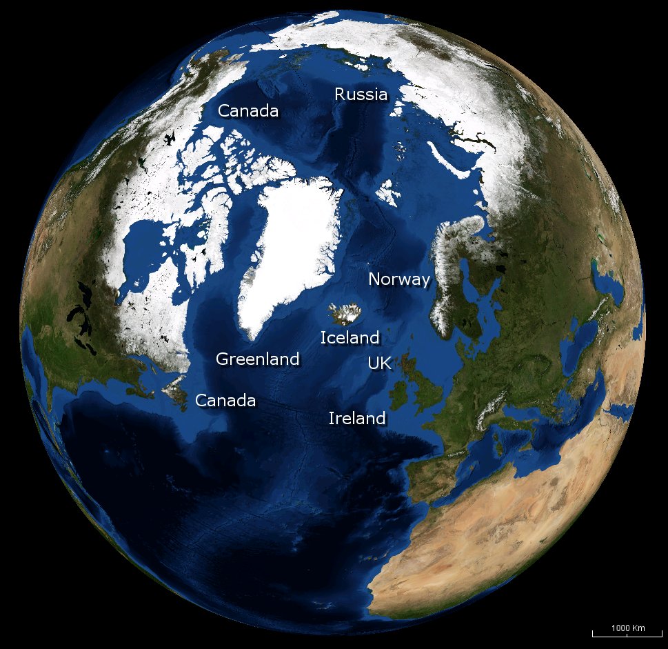
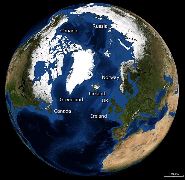
English: Image of the Earth with Iceland in the centre, with nearby countries labelled. |
|||
| Date | ||||
| Source | NASA | |||
| Author | Andrew Oakley | |||
| Permission (Reusing this file) |
|

File history
Click on a date/time to view the file as it appeared at that time.
| Date/Time | Thumbnail | Dimensions | User | Comment | |
|---|---|---|---|---|---|
| current | 11:50, 13 October 2008 | | 969 × 941 (179 KB) | Evilandi | {{Information |Description={{en|1=Image of the Earth with Iceland in the centre, with nearby countries labelled.}} |Source=NASA |Author=Andrew Oakley |Date=2008-10-13 |Permission={{PD-WorldWind}} |other_versions= }} <!--{{ImageUpload|full}}--> |
File usage
The following page uses this file: