LOG IN. UPLOAD PICTURES.
The Philippines has Zambo Mart to help propagate the Chavacano Language.
Difference between revisions of "Akrotiri"
| Line 11: | Line 11: | ||
</html> | </html> | ||
<!--- google head end ---> | <!--- google head end ---> | ||
{{Akrotiri cities}} | {{Akrotiri cities}} | ||
{| class="wikitable" style="margin: 1em auto 1em auto; border: 0px;" | {| class="wikitable" style="margin: 1em auto 1em auto; border: 0px;" | ||
Latest revision as of 16:16, 8 February 2022
|
|
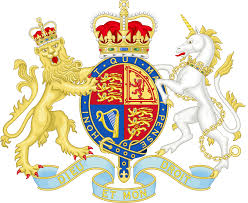
THE AKROTIRI COAT OF ARMS
| |||
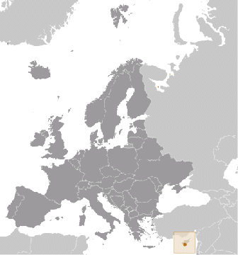
 Location of Akrotiri within the continent of Europe | |||
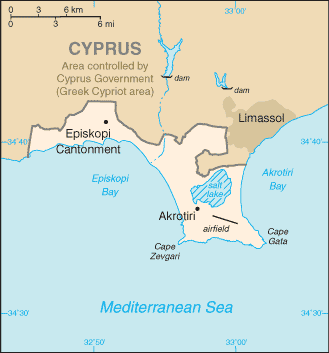
 Map of Akrotiri | |||
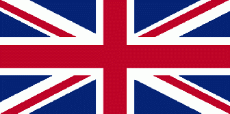
 Description of Flag: Akrotiri flies the flag of the Unied Kingdom | |||
|
Background of Akrotiri

Prehistoric Site of Akrotiri, Santorini - Greece.jpg Axis D12-D13 of the under-construction Shelter above the archaeological site of Akrotiri.
The Sovereign Base Areas of Akrotiri and Dhekelia are two British-administered areas comprising a British Overseas Territory on the island of Cyprus administered as Sovereign Base Areas of the United Kingdom. The bases were retained by the British following the granting of independence and the eventual transition of Cyprus from a crown colony to an independent sovereign state.
Geography of Akrotiri
- Location : Eastern Mediterranean, peninsula on the southwest coast of Cyprus
- Geographic coordinates: 34 37 N, 32 58 E
- Map references: Middle East
- Area: total: 123 sq km, note: includes a salt lake and wetlands
- Area - comparative: about 0.7 times the size of Washington, DC
- Land boundaries: total: 48 km, border countries: Cyprus 48 km, Coastline 56.3 km
- Climate: temperate; Mediterranean with hot, dry summers and cool winters
- Environment - current issues: hunting around the salt lake; note - breeding place for loggerhead and green turtles; only remaining colony of griffon vultures is on the base
- Geography - note: British extraterritorial rights also extended to several small off-post sites scattered across Cyprus; of the Sovereign Base Area (SBA) land, 60% is privately owned and farmed, 20% is owned by the Ministry of Defense, and 20% is SBA Crown land
Demographics of Akrotiri
- Population: approximately 15,700 live on the Sovereign Base Areas of Akrotiri and Dhekelia including 7,700 Cypriots, 3,600 Service and UK-based contract personnel, and 4,400 dependents
- Languages: English, Greek
Economy of Akrotiri
- Economy - overview: Economic activity is limited to providing services to the military and their families located in Akrotiri. All food and manufactured goods must be imported.
- Exchange rates: note: uses the euro
Telecommunication of Akrotiri
- Broadcast media: British Forces Broadcast Service (BFBS) provides multi-channel satellite TV service as well as BFBS radio broadcasts to the Akrotiri Sovereign Base (2009)
Military Profile of Akrotiri as of 2014
- Military - note defense is the responsibility of the UK; Akrotiri has a full RAF base, headquarters for British Forces Cyprus, and Episkopi Support Unit
Population of Akrotiri
- Population: no indigenous inhabitants
note: approximately 1,300 military personnel are on the base; there are another 5,000 British citizens who are families of military personnel or civilian staff on both Akrotiri and Dhekelia; Cyprus citizens work on the base, but do not live there
Government of Akrotiri
- Country name: conventional long form: none
- conventional short form: Akrotiri
- Dependency status: a special form of UK overseas territory; administered by an administrator who is also the Commander, British Forces Cyprus
- Capital
- name: Episkopi Cantonment (base administrative center for Akrotiri and Dhekelia)
- geographic coordinates: 34 40 N, 32 51 E, time difference: UTC+2 (7 hours ahead of Washington, DC, during Standard Time)
- daylight saving time: +1hr, begins last Sunday in March; ends last Sunday in October
- Affiliation :(UK Sovereign Base Area)
- Constitution :presented 3 August 1960, effective 16 August 1960; amended 1966 (The Sovereign Base Areas of Akrotiri and Dhekelia Order in Council 1960, serves as a basic legal document) (2013)
- Legal system: laws applicable to the Cypriot population are, as far as possible, the same as the laws of the Republic of Cyprus; note - the Sovereign Base Area Administration has its own court system to deal with civil and criminal matters
- Executive branch
- chief of state: Queen ELIZABETH II (since 6 February 1952)
- head of government: Administrator Major General Richard CRIPWELL (since January 2013); note - reports to the British Ministry of Defense; the Chief Officer is responsible for the day-to-day running of the civil government of the Sovereign Bases
- elections: none; the monarchy is hereditary; the administrator appointed by the monarch
- Judicial branch: \
- highest court(s): Senior Judges' Court (consists of several visiting judges from England and Wales)
- judge selection and term of office: judges appointment and tenure NA
- subordinate courts: Resident Judges' Court; Courts Martial
- Diplomatic representation in the US
- none (overseas territory of the UK)
- Diplomatic representation from the US: none (overseas territory of the UK)
- National anthem: note: as a United Kingdom area of special sovereignty, "God Save the Queen" is official (see United Kingdom)
| THE NATIONAL ANTHEM |
|---|
|
God save our gracious Queen Long live our noble Queen God save the Queen Send her victorious Happy and glorious Long to reign over us God save the Queen O Lord our God arise Scatter her enemies And make them fall Confound their politics Frustrate their knavish tricks On Thee our hopes we fix God save us all Thy choicest gifts in store On her be pleased to pour Long may she reign May she defend our laws And ever give us cause To sing with heart and voice God save the Queen Not in this land alone But be God's mercies known From shore to shore Lord make the nations see That men should brothers be And form one family The wide world over From every latent foe From the assassins blow God save the Queen O'er her thine arm extend For Britain's sake defend Our mother, prince, and friend God save the Queen |
History of Akrotiri
Akrotiri was first constructed in the mid-1950s to relieve pressure on the main RAF station on the island, RAF Nicosia. In the aftermath of the Egyptian repudiation of the Anglo-Egyptian treaty, British forces had to be withdrawn from the Canal Zone in Egypt. After the ending of the League of Nations mandate over Palestine in 1948, the only other British territory in the eastern Mediterranean was Cyprus. Consequently, the withdrawal from Egypt caused an enormous build-up of forces in Cyprus. This period also coincided with the outbreak of the internal security problems of EOKA in Cyprus, further increasing pressure on the RAF airfields on the island.
Even this massive influx from Egypt was not the end. In late 1956, relations between the United Kingdom and Egypt had reached crisis point. The Suez Crisis saw a further increase in the strength of RAF forces in Cyprus. Akrotiri was mainly an airfield for fighter, photo reconnaissance and ground attack aircraft. Its regular squadrons of Meteor night fighters, Canberra photo reconnaissance aircraft and Venom ground attack machines were reinforced by further Canberras and Hunters from Fighter Command in the United Kingdom. The airfields in Cyprus were so overcrowded that there was a real fear of massive loss of equipment should the Egyptian Air Force decide to attack the island. Fortunately for the RAF, that attack never came. The overcrowding extended beyond Cyprus. Significant RAF units from Bomber Command were deployed to RAF Luqa in Malta, crowding that station as well.The attack on Egypt was a military success, despite interference in the plan which reduced its effectiveness. However, it was a political fiasco, because the United States put considerable pressure on the United Kingdom and France both economically and politically. This quickly forced the Eden government from power. The quickness of the climbdown was good news for the personnel at Akrotiri. The station's complement quickly returned to normal after the crisis passed, with the reinforcing units that had crowded it during the war returning either to the United Kingdom or to other parts of the Middle East Command.
After the Suez Crisis, the main emphasis of life on the airfield shifted to helping quell the EOKA revolt and training missions. After the withdrawal from both Egypt and Iraq, and débâcle of Suez, it was clear that a command centred on Cyprus could not control units stationed in the Arabian Peninsula, of which there were still many. Consequently, the Middle East Command was split, with that east of Suez being controlled from Aden, and the rump being renamed the Near East Command, controlled from Cyprus. From 1957 to 1969, four squadrons of Canberras (Nos 6, 32, 73, and 249) provided first a conventional and then from November 1961, a nuclear striking capability as part of the Baghdad Pact, later CENTO.[2]
Akrotiri, along with Nicosia, assumed a very important status, as virtually the sole means for projecting British airpower into the eastern Mediterranean, outside of aircraft carriers. In 1960, independence was granted to Cyprus, with the RAF maintaining both RAF Nicosia and RAF Akrotiri as airfields, controlled by the Near East Air Force. However, Akrotiri assumed more and more importance as Nicosia was used for greater and greater amounts of civil aviation traffic. After 1966, it was no longer possible to maintain RAF units at Nicosia due to pressures of space, and Akrotiri became the only RAF flying station left on the island.
In August 1970 a detachment of "G" of the Central Intelligence Agency arrived at the airfield with U-2 aircraft to monitor the Egypt/Israel Suez Canal fighting and cease fire. Later permanent monitoring of Middle East Ceasefire after 1973 Yom Kippur War. It became the 100th Strategic Reconnaissance Wing OL "Olive Harvest" in 1974.[3]
Up until 1974 RAF Akrotiri had a balanced force of aircraft assigned to it, including No. 9 Squadron RAF and No. 35 Squadron RAF flying Vulcans. The Vulcans provided a bomber force for the Central Treaty Organisation, one of the three great anti-Communist mutual defence pacts signed in the early days of the Cold War.[4] However, during that year, Turkish forces invaded Cyprus in connection with a Greek-sponsored coup. The UK then evacuated most of the RAF from Akrotiri as the CENTO treaty had degenerated to the point of uselessness. The two Vulcan squadrons left for UK stations in 1975. What was left at the airfield was the flying unit that is permanently assigned to the station to this day; No. 84 Squadron RAF, a search and rescue unit flying helicopters.[5] In addition the role of No. 34 Squadron RAF Regiment was changed from Low level Air Defence to infantry and counter terrorist duties.
In September 1976 the US U-2 operations were turned over to the 9th Strategic Reconnaissance Wing, but the U-2 operation at RAF Akrotiri continued to be called Operating Location OH until September 1980. Thereafter it became Detachment 3 of the 9th SRW, although the name OLIVE HARVEST continues. Two U-2s are stationed at RAF Akrotiri and they are still monitoring the ceasefire agreement between the Egypt and Israel although the present operations in Central Command requires further missions. U-2s also transit through RAF Akrotiri either on going into the Central Command theatre or returning to Beale AFB.
In the mid-1980s, the US launched retaliatory attacks against Libya after the country's leader, Muammar al-Gaddafi, was implicated in terrorist attacks against US military bases. Although the bombers were staged out of the United Kingdom, RAF Akrotiri was employed in the role of an alternate in case of emergency, and was used as such by at least one aircraft. This caused a severe upgrade in security around the airfield as Libya threatened to respond against locations used in staging the attacks. The threat was carried through with an attack on the station on 3 August 1986 with mortars, rocket-propelled grenades and small arms. Three British dependants were wounded although damage was negligible. Security at the station remained high with substantial fortifications constructed along its northern perimeter, until the first Gulf War. The attack was carried out by an unknown supposed Palestinian group but it was generally assumed that this was commissioned and underwritten by Libya.
The southern cliffs of the peninsula host the earliest known archaeological site in Cyprus, at a locality known as Aetokremmos. This is a hunter-gatherer site dated to 12,000 years ago with findings which include bones of pigmy hippos and pigmy elephants...>>>Read On<<<
Ancient Akrotiri, Santorini
Ancient Akrotiriis a fascinating and important archaeological site on the Greek island of Santorini. Dubbed the "Minoan Pompeii," the flourishing town was at once destroyed and preserved around 1450 BC by a volcanic eruption. Today it has been partially excavated and is protected from the sun inside a large shed.---->>>>>Read More<<<<.
Santorini Archaeological Sites : Akrotiri Excavations
The excavations at Akrotiri have uncovered one of the most important prehistoric settlements of the Aegean. The first habitation at the site dates from the Late Neolithic times (at least the 4th millennium BC)...>>>read on<<<<
Akrotiri - Minoan City on the Island of Santorini
Akrotiri is the name of a small Minoan settlement located on the volcanic island of Thera (or Santorini) in the Aegean Sea. Occupied first in the late Neolithic period during the fourth millennium BC, Akrotiri grew to an important trade center during the middle and late Bronze Age, with an elaborate drainage system and a palace.In the late 17th century BC, a series of earthquakes forced the abandonment of the town, and a good thing too: Thera erupted shortly afterward, covering the city in ash and splitting the island in two.
Akrotiri has been suggested as a possible origin of Plato's Atlantis legend; archaeologists are more interested in the effects the eruption had on the Minoan culture. Most recently, controversy has stirred over the precise date of the eruptions at Akrotiri, with both ice core and volcanic dates indicating that the volcano erupted about 1625 BC, or about 100 years earlier than traditional dates.
Pre-Historic, Buried City Of Akrotiri On Greek Island Reopened For Tourists
After an unprecedented closure for seven years, the prehistoric city of Akrotiri, located at the volcanic cycladic island of Santorini in Greece, was reopened for tourists Wednesday.
The Greek Minister of Culture and Tourism Pavlos Geroulanos announced the opening of the archaeological site following his visit to Akrotiri.
Today reopens to the public an archaeological site of global concern. Those who were lucky enough to visit the cape earlier remained speechless in front of the richness and beauty of the findings, Geroulanos said in a statement.
The site was closed since 2005 after a roof structure, which was being constructed to protect the site, collapsed, killing a British tourist.
Geroulanos said that since the safety of visitors was a top priority, the cultural ministry has done all safety tests before opening the site to the public.
We are now able to say that the thousands of visitors to the site can enjoy safely.
According to the ministry of Greek culture and tourism, Akrotiri is one of the most important prehistoric settlements of the Aegean with first habitation at the site traced back to the Late Neolithic times around 4th millennium BC. By the start of the Late Bronze Age some 3700 years ago, Akrotiri served as a major urban center and port city of the Aegean.
Located on the popular tourist island of Santorini in the southern Aegean Sea, off southeast of Greece's mainland, the city of Akrotiri was buried under the pumice and ash from the eruption of the Santorini volcano in 1700 BC, just like in Pompei.
However, unlike Pompei, the inhabitants were able to abandon the city much before the eruption as a result of a series of earthquakes that happened before the eruption.
The volcanic materials that covered the entire town have eventually protected the buildings and their contents till date. There are three-and-four storey buildings that are still intact, with well-preserved murals, frescoes, wall paintings and objects such as furniture pieces and vessels inside them.
The artifacts excavated from Akrotiri, one of the leading archaeological sites of Greece, are displayed at the new museum of Prehistoric Thera at Santorini.
Disclaimer
This is not the official site of this country. Most of the information in this site were taken from the U.S. Department of State, The Central Intelligence Agency, The United Nations, [1],[2], [3], [4], [5],[6], [7], [8], [9], [10], [11], [12], [13], [14],[15], [16], [17], [18], [19], [20], [21], [22], [23], [24],[25], [26], [27], [28], [29], [30],[31], [32], [33], [34], and the [35].
Other sources of information will be mentioned as they are posted.

